Walking the Hodder - Stage 1
Hurst Green to Higher Hodder Bridge
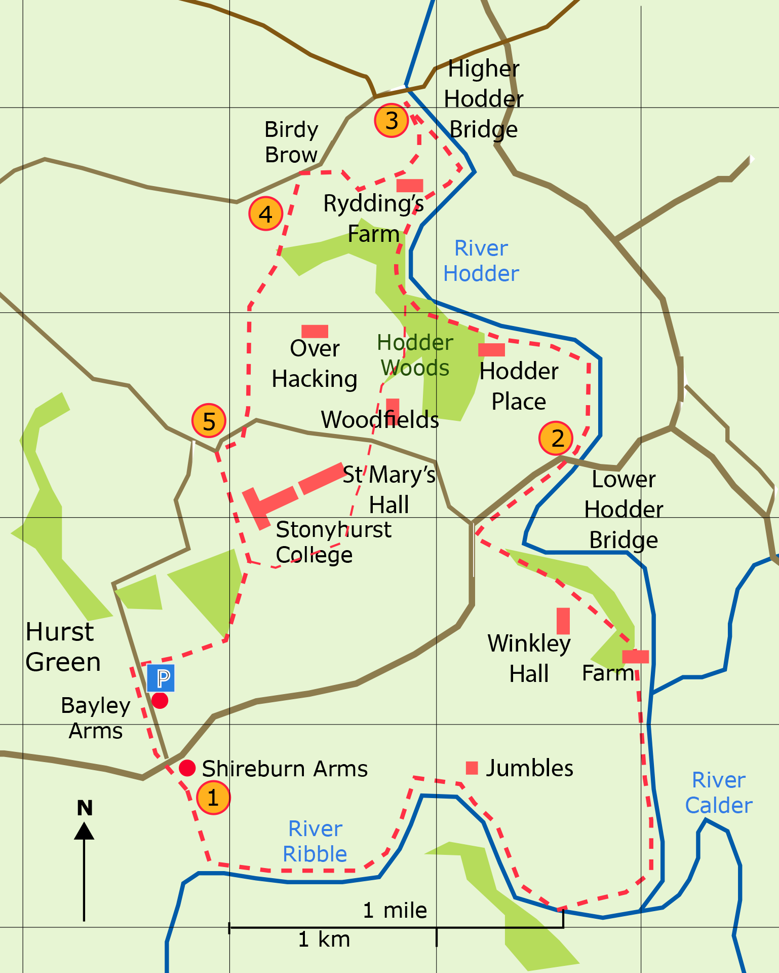
Distance 9.23 miles : time about 4 hours 15 min
<Stage 5  Stage
1
  Stage 2 >

230322


is now closed.
Stage 1: Hurst Green to Higher Hodder
Bridge
 The path
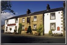
starts at the gate in the car park of the Shireburn Arms. Go straight
downhill following the ditch; after 300 yd cross the ditch and
continue to the wood. Go over the stile across the beck and down
to the Ribble. The Ribble Way hugs the river all the way to the
farm adjacent to Winkley Hall. The path zigzags through the farm
yard and leads to the farm road going uphill. As the road bends
to the left, a Ribble Way sign is seen on the right next to a small
metal gate. The path is seen across the field. Go through a second gate
and follow the edge of the wood. The path ends at the road opposite a stone bus shelter. Turn right and walk to the Lower Hodder Bridge. (1 hr 40 min)
 The path
continues along the side of the Hodder and starts to climb into
Hodder Woods at Hodder Place. (The area alongside the Hodder here is a SSSI on account of its geological importance; see the map and read more here )
The path
continues along the side of the Hodder and starts to climb into
Hodder Woods at Hodder Place. (The area alongside the Hodder here is a SSSI on account of its geological importance; see the map and read more here )(For an alternative return to Hurst Green see below).The path descends to a stone bridge at which a detour to the right shows the site of the former mill at Black Wheel. After which a wooden flight of 92 steps lead to the top of the high escarpment overlooking the river. Bear right at the memorial stone cross and continue through the wood crossing three wooden footbridges emerging onto meadow land on the Hodder bank. A pleasant stroll along the Hodder now ensues. The path next enters the wood at a wooden gate and footbridge and continues over three further footbridges to Higher Hodder Bridge.(60 min)
 Retrace the path from the Bridge and find the return path 10 yds to the right after crossing the second wooden footbridge. The narrow path goes uphill; at the end of the wire fence turn right and descend to go over a plank footbridge and through the metal gate. Walk up the field and follow the wire fence on the left, go by Rydding's Farm and continue to the double metal gate at the roadway. Turn right along the roadway. 100 yds before the next house look for the small stile at the double metal gate. Bear right and walk uphill for 200 yds to the road - Birdy Brow. (25 min)
 At the roadside
a FP sign points the way following the line of mature trees. Aim
to the right of the wood ahead. The path crosses the stream to
the right of a large black pipe and ascends towards an old narrow
metal gate. The path is not well defined after this point. Bear
right over the field and follow the wire fence downhill to the
stile at its end. Over the stile follow the hedge on the left to
the next stile. Cut across the top of the field and follow the
hedge on the right for 30 yd to the next stile. Go through the
wide metal gate seen on the left and carry on over the field to
the final stile found in the corner of the field. Continue in the
same direction over the field to the road. (30 min)
 Turn right
along the road and then left into the grounds of Stonyhurst College.
The route goes in front of the College and past the church. A FP
sign is seen on the right. Go through the new metal gate into the
field and follow the edge of the wood and then the hedge. The path
passes through three metal swing gates and leads into Smithy Row in Hurst Green. (45 min)
