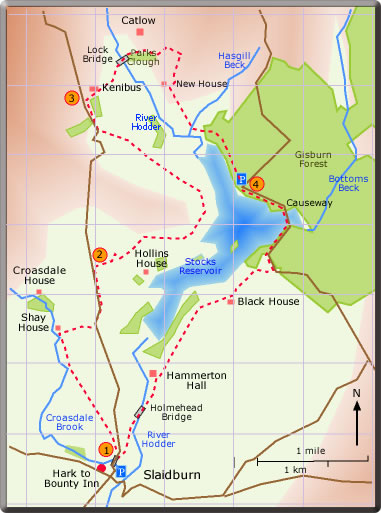
A circular walk from Slaidburn
to Stocks Reservoir
distance 10.76 miles : time 5 - 6 hours
< previous
walk walk
9 next
walk >
walk
9 next
walk >
A circular
walk from Slaidburn around
Stocks Reservoir
Stocks Reservoir was built between 1923-32 to supply water
to the Blackpool area. The site of the old village Stocks-in-Bowland now lies
beneath its water. The north eastern shore of the reservoir is skirted by
Gisburn Forest, this together with the area around the reservoir forms an
important wild life reserve.
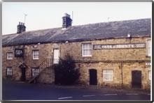
Slaidburn as in former days is regarded as the capital of the Forest of Bowland. The Hark to Bounty Inn formerly served as the Forest Court; a panelled room upstairs which served as the court room is still to be seen.
At 11 miles the walk is the longest in this series. As described the walk starts in Slaidburn, but an alternative start is from the parking area in Gisburn Forest with the Hark to Bounty the objective for lunch.