Ingleborough together with Whernside, and Pen-y-Ghent are collectively know as the Three Peaks.
After Whernside, Ingleborough is the second highest mountain in the Yorkshire Dales.
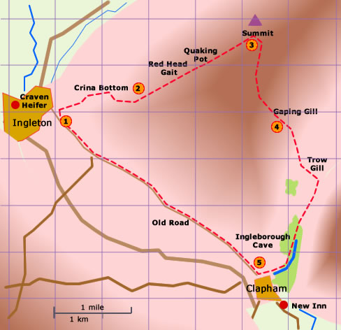
In this walk the climb to the summit of Ingleborough gets the hardest part of the walk over first.
The second part, the descent into Clapham by way of Gaping Gill is by comparison just a stroll.
The third part along the road back to Ingleton can be quite tiring after the climb. This stretch can be saved by taking the bus !
After Whernside, Ingleborough is the second highest mountain in the Yorkshire Dales.
In this walk the climb to the summit of Ingleborough gets the hardest part of the walk over first.
The second part, the descent into Clapham by way of Gaping Gill is by comparison just a stroll.
The third part along the road back to Ingleton can be quite tiring after the climb. This stretch can be saved by taking the bus !
A
circular walk from Ingleton over Ingleborough to Clapham
Distance 11.00 miles; time about 6 hr
< previous
walk walk 11 next
walk >
walk 11 next
walk >
The descent starts at the southern end of the plateau with a long distance view to Gaping Gill. The path is fairly steep to begin with but becomes much easier along the paving. At Gaping Gill the path is grassy and almost on the level. (60 min)
Alternatively carry on straight down the village road to take some refreshment at the New Inn. And then take the bus back to Ingleton; the bus stop is opposite the village shop. (10 min)
DalesBus Timetable
190215
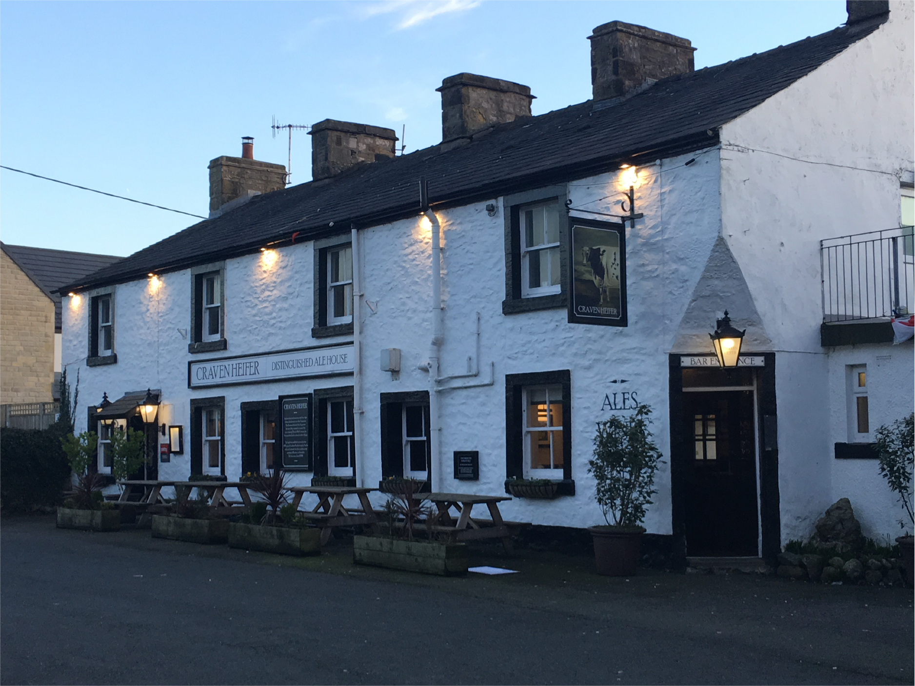 Craven Heifer, Ingleton