A circular walk from Barley
around Four Reservoirs
distance 6.10 miles : 3 hours 30 min
< previous
walk walk
13 next
walk >
walk
13 next
walk >
A circular
walk from Barley around four Reservoirs
On reaching Pendle House the path continues through the gate on the right, along the back of the house, and then follows the contour along the fell side. Shortly before Under Pendle go over the stile at the double gate; the houses are overlooked from the path. The path now crosses a brook and continues to follow the contour; Buttock is seen from high. After crossing a stile the path enters a narrow cleft and become quite rocky; shortly after the path descends and circles the top end of the reservoir. The descent continues into Ogden Clough. At the bottom turn left through the gate. (90 min)
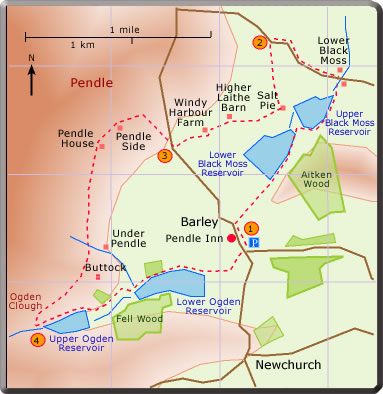
The four reservoirs viewed on this walk supply water to local towns. The Upper and Lower Ogden Reservoirs are supplied by water from Ogden Clough; the Upper and Lower Black Moss Reservoirs by Black Moss Beck. It is not surprising that reservoirs are found at the foot of Pendle. A local saying: "if you can not see Pendle it's raining; if you can see Pendle expect rain'.
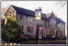
The first leg of the walk from Barley to Black Moss Farm is a pleasant stroll between the two reservoirs on the left and Aiken Wood on the right. After a walk uphill along the road, the next stretch generally follows the contour in the shadow of Pendle passing through a series sheep pasture and farms. On reaching Ogden Clough the final leg back to Barley passes close to the two Ogden reservoirs. The walk offers a continuous change in scenery: fellside, water, wood and pasture land. The Pendle Inn or the Barley Mow are popular final resting places.
The first leg of the walk from Barley to Black Moss Farm is a pleasant stroll between the two reservoirs on the left and Aiken Wood on the right. After a walk uphill along the road, the next stretch generally follows the contour in the shadow of Pendle passing through a series sheep pasture and farms. On reaching Ogden Clough the final leg back to Barley passes close to the two Ogden reservoirs. The walk offers a continuous change in scenery: fellside, water, wood and pasture land. The Pendle Inn or the Barley Mow are popular final resting places.
190224