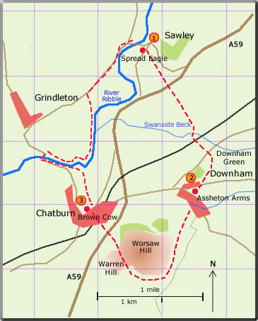
A circular walk from Sawley
- Downham - Chapburn
distance 6.59 miles : time 3 hours
This walk is one of the author's favourites. Leaving the Spread Eagle in Sawley the ruins of Sawley Abbey are seen as the walker passes over the meadowland aiming for the left-hand slope of Pendle. An old pack horse bridge is crossed on the way. The path descends into the lovely village of Downham and continues around the geological feature of Worsaw Hill. Now comes a steep descent on the way to Chatburn and then on to the homeward stretch following the Ribble. Each village supports a traditional pub.
A
circular walk from Sawley to Downham and Chatburn
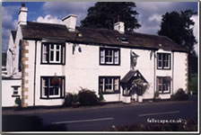
 The walk starts at the stile found in the Spread Eagle car park. Bear right (140°) walk over the field to the stone stile and continue to the small gate. Cross the track and continue through the wood alongside the beck. After two further small gates the track leads to the A59. Cross with great care. Over the stile head for the left-hand slope of Pendle (140°). Go through the double metal gate; after the next stile follow the hedge on the left to the next stile. The FP goes across the field to the next stile. Aim about 100 yd to the left of the far right hand corner. (At the time of writing there was a crop in the field so it was thought best to follow the hedge on the right to the bottom corner and then turn left alongside the field edge to the stile). After the stile bear slightly left and walk downhill to the stile just before the old stone pack-horse bridge over Swanside Beck. (30 min)
After crossing look for the stone stile on the left and follow the wood around to the railway bridge. Continue to follow the edge of the wood to a double gate and so on to the road. Cross the road and follow the track to the wood yard. Waymarkers are seen on the right which lead uphill over Downham Green. The path follows the escarpment to the wood seen in the distance. The path now goes uphill alongside the edge of the wood into Downham. (30 min)
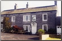
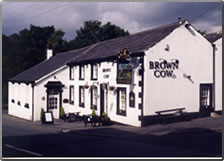
 From the Assheton Arms walk downhill to Downham Beck; turn right at the bridge. The FP starts at a squeezer stile found between the two cottages. Follow the fence on the right to the next squeezer stile. The path now bears slightly left away from the stone wall across the field to the next squeezer stile. Yet a fourth squeezer stile is encountered at the foot of Worsaw Hill. The path is now easy and follows the contour of the hill around to the right. A gentle climb takes the walker to the right of Warren Hill. At the top Chatburn comes into view and after a rather steep descent the straight path continues to the A59. Again cross with great care and follow the alley into Chatburn. Turn left at the first street and walk downhill to the Brown Cow on the main road. (60 min)
 The return to Sawley is straightforward following the Ribble Way. Walk downhill from the side of the Brown Cow to meet the Ribble and follow the concessionary path to Grindleton Bridge. The Ribble Way continues following the other bank. The path eventually leaves the river at a stile which directs the walker across the field heading for Bowland High seen in the distance. A new gate is found at the wall (where there was formally a ladder stile) bear right and walk uphill to the road. Turn right along the road to Sawley. (60 min)

190623
 walk
17
walk
17