This circular walk in Upper Wharfedale from Arncliffe to
Buckden offers the walker a number of contrasting sights.
A pub features in all the walks on this site, however, there
are 6 to choose from on this circular walk! The walk starts
in Arncliffe with a climb up Old Cote Moor and descent into
Kettlewell.
The Dales Way is followed along the banks of the Wharfe to
Buckden with a possible stop at Starbotton. The return leg
from Buckden takes a route over Firth Fell through the National
Trust Access Area. A steep ascent to the trig point at the
top affords panoramic views of the area; followed by an equally
steep descent to Litton. The walk concludes in Littondale
with a relaxing stroll along the bank of the River Skirfare
back to Arncliffe.
So two alternatives are offered:
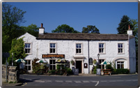
1. Arncliffe - Kettlewell - Starbotton - Arncliffe is 6.6 miles.
2. Arncliffe - Starbotton -Buckden - Litton - Arncliffe is 10 miles
A circular
walk in Wharfedale from Arncliffe to Buckden
Distance 11.98 miles: time requires about 5 hours
< previous
walk walk 8 next
walk >
walk 8 next
walk >
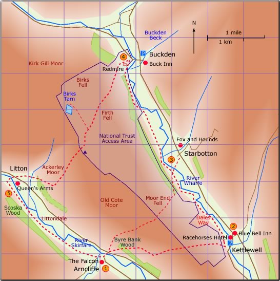
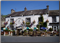
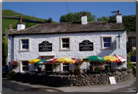
Follow the road sign to Litton. The FP sign to Kettlewell is seen to the right just after the road bridge. A steep uphill climb over stiles and through gates now ensues. The path is often rocky in places. A ladder stile at the top of the climb leads into the National Trust Access Area; a grassy path leads down into Kettlewell. On meeting the road the Dales Way to Starbotton is seen on the left. Otherwise carry on over the road bridge to the Blue Bell Inn or the Racehouses Hotel. (2.5 miles; time 75 min)
Follow the road sign to Litton. Go over the road bridge to the T-junction; the FP to Starbotton start here. After an initial steep climb through the meadow the path bears right along the bridleway. The path is straightforward; climbing to the top of the fell and then down into Starbotton. (2.5 miles; time 105 min)
Carry on along the Dales Way. The path is quite straightforward and well trodden. For a diversion to the Fox and Hounds use the path over the footbridge to Starbotton. (2 miles; time 50 min)
The Dales Way continues to Buckden. On reaching the road close to Buckden turn right to find the Buck Inn just after the village green. (2 miles time 55 min)
The path starts on the roadside on the right about 250 yd from the Fox and Hounds. After the bridge follow the FP sign to Arncliffe. (2.5 miles; time 105 min)
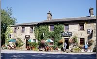
Retrace the path along the road to Redmire and look for the BW sign to Litton. A steady climb ensues which initially zig-zags up the fell side. The path continues following blue waymarkers up the steep fell side. On approaching the fell top follow the stone wall on the right. The trig point can be seen some distance away on the left. Carry on through the wooden gate. The path now descends again following the dead straight wall; at the end of which the path bears right and Litton can be seen in the distance. The Queens Arms is on the right on entering the village. (3.5 miles; time 125 min)
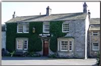
The path to Litton continues 20 yd after the pub; a BW sign points to the ford over the River Skirfare. At the river turn left and then almost immediately right over the ford. The FP sign to Arncliffe points the way; initially following close to the river and then over meadow land. The path goes through the English Nature Reserve of Scoska Wood. On reaching Arncliffe the Falcon Arms is seen on the left. (2 miles; time 55 min)